Hiking in Ellijay: A Local's Guide to the Best Trails
Discover Ellijay
April 13, 2026
7 min read
If Ellijay has a secret, it's that the hiking here rivals anything in better-known parts of the North Georgia mountains — without the crowds. You can stand under a 100-foot-tall tulip poplar that dates back to before logging came through. You can stroll a lakeside loop that's flat enough for a stroller and pretty enough to post. You can chase waterfalls off a gravel road most visitors never find. And you can do most of it within a thirty-minute drive of downtown.
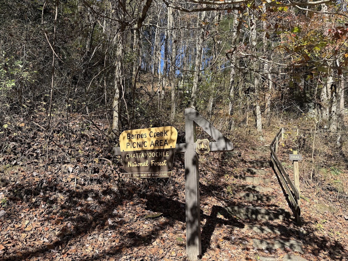
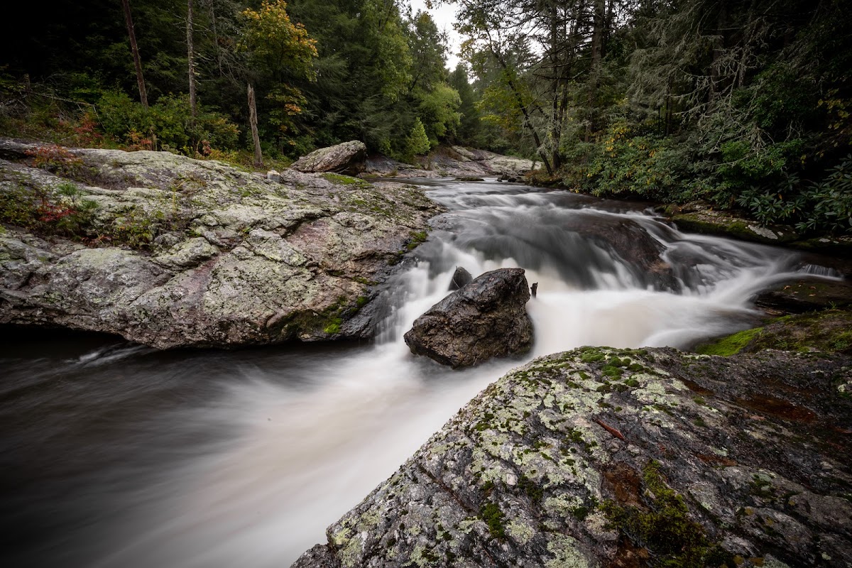
Barnes Creek Falls is a serene roadside waterfall nestled in the Cohutta Wilderness. Accessible via a brief walk from the Barnes Creek Picnic Area, it offers a tranquil setting for visitors. The falls are particularly stunning after rainfall, showcasing a robust flow over moss-covered rock. The area also features a picnic table, making it an ideal spot for a peaceful lunch amidst nature.
Ellijay
View Listing
Barnes Creek Falls
A 15-foot slide waterfall tucked into the Cohutta Wilderness, accessible with essentially no hiking required. A short walk from the Barnes Creek Picnic Area puts you at the base of a moss-covered rock face where the water splits into two ribbons on its way down. One of the easiest waterfall payoffs in the region.
What to do: Pull in, walk the short path to the falls, and linger at the picnic area. Bring a lunch and make it a slow stop rather than a quick photo.
Best time to visit: After a good rain, when the flow is full. In dry stretches it can slow to a trickle, so check the weather before you go.
Insider tip: The picnic table right near the falls is a real one — pack sandwiches and eat with the water in view. Also, the gravel road in can be rough; drive a little slower than you think you need to.
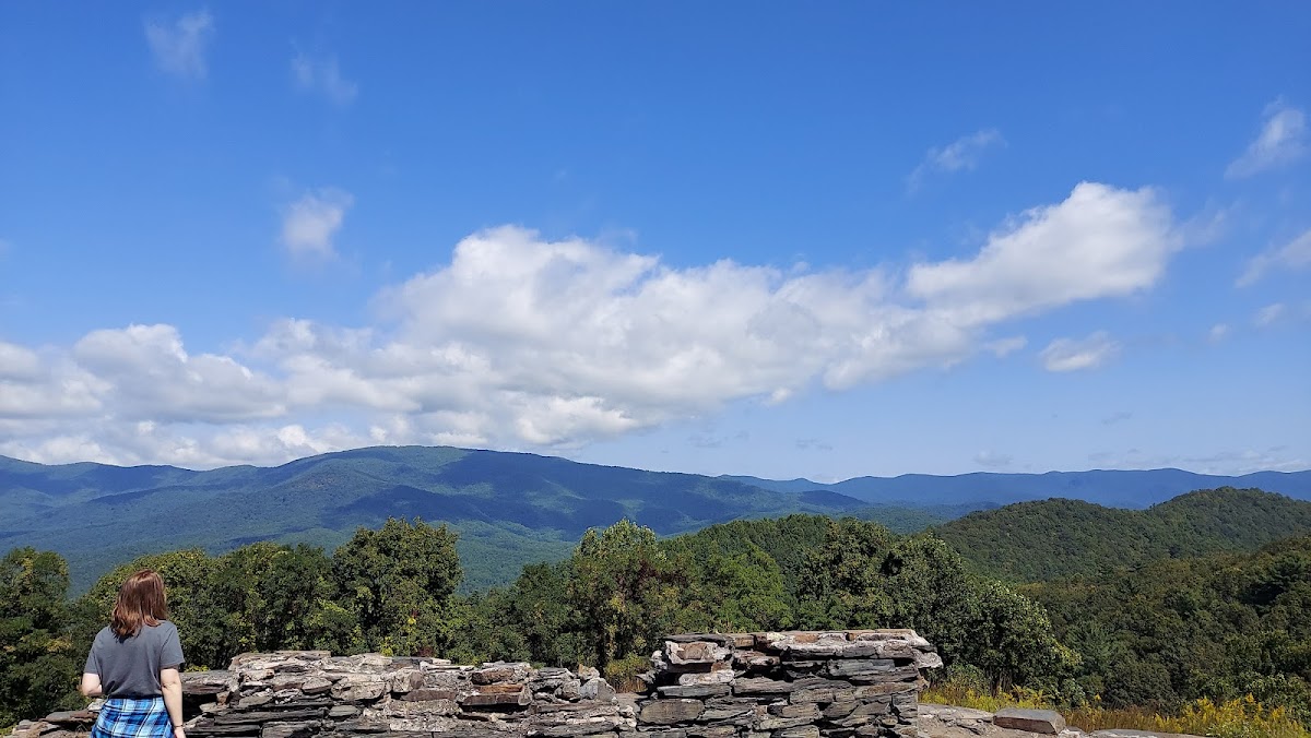
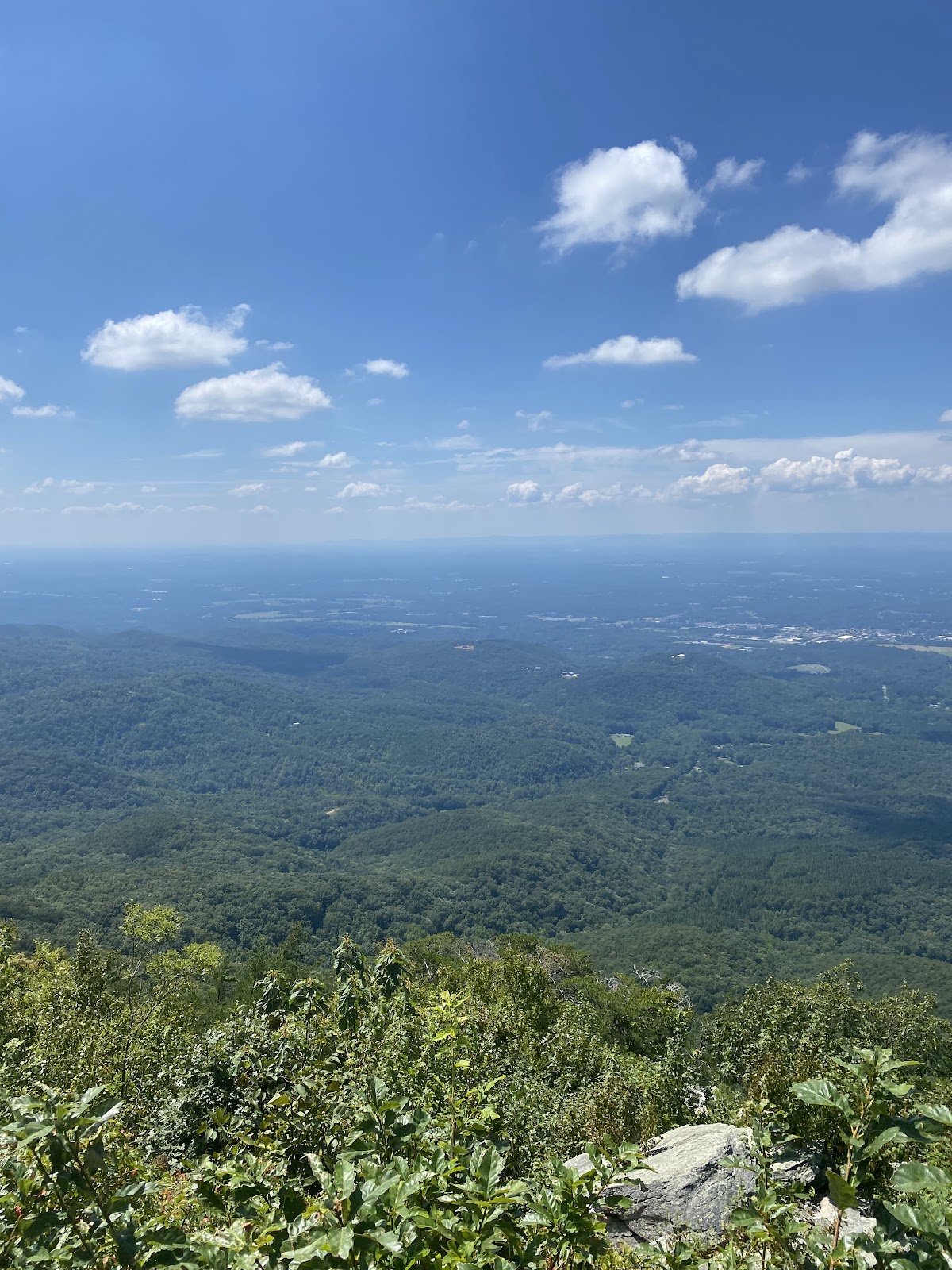
A short uphill trail off Highway 52 between Ellijay and Chatsworth that delivers a nearly 360-degree view from the top of a mound on the edge of the Cohutta Wilderness. Low effort, very high reward — on a clear day, the mountains and valleys stretch out in every direction.
What to do: Park at the loop off Route 52, take the brief uphill walk to the viewing area, and give yourself ten minutes to actually look around.
Best time to visit: Early morning for soft light and no haze, or late afternoon for sunset. Spring and fall days offer the clearest views.
Insider tip: Section 16 of the Pinhoti Trail starts about 800 feet west of the Cohutta Overlook exit road — if you want to extend a short stop into a real hike, this is your on-ramp.
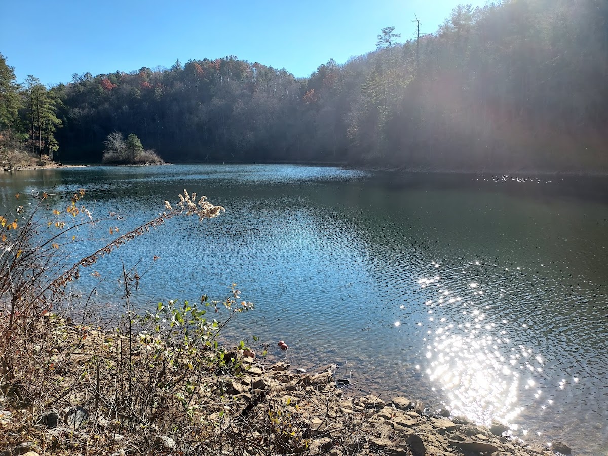
A 1.2-mile loop around the 17-acre lake inside Fort Mountain State Park. Flat, shady, and easygoing — the path winds through forest, past a sandy swimming beach, through a quiet creek valley, and alongside the campground. Kid-friendly, stroller-friendly, dog-friendly.
What to do: Walk the full loop at a slow pace. Hit the swimming beach in summer. Stop at one of the lakeside benches to take in the view.
Best time to visit: Spring for new leaves and wildflowers, summer for the beach, early fall for color. Any clear-weather weekday is ideal.
Insider tip: Park at the picnic area or Big Rock Trail lot instead of the main campground entrance — the access is easier and you'll avoid the busiest stretch in peak season.
A 1.0-mile out-and-back trail at the Ridgway Recreation Area at the northeast end of Carters Lake, about a 20-minute drive from Ellijay. The highlight is an iconic 150-foot bridge that stretches over the rapids of Tails Creek, with a short spur down to the base of the falls.
What to do: Walk to the bridge, cross it for the best view of the creek below, and take the path down to the water if you want to get closer to the cascades.
Best time to visit: Spring, when the water is running hard and the bridge view is at its best. Moderate difficulty despite the short distance, so bring decent shoes.
Insider tip: There's a $3 daily fee at Ridgway. Bring small bills or exact change, and double-check the entrance station before hiking in.
A 1.5-mile out-and-back trail off Blackberry Mountain Road that leads to rapids, a small cascade called Clear Creek Falls, and a peaceful stretch where Clear Creek meets the Cartecay River. Relatively easy, very rewarding, and still flies under most visitors' radar.
What to do: Follow the trail down to the creek, explore the rapids, and continue to the confluence with the Cartecay if you want a little more distance.
Best time to visit: Late spring and early summer, when the creek is running strong and the forest is fully leafed out.
Insider tip: This is on the Rich Mountain WMA – Cartecay Tract, which requires a Georgia DNR land pass (or a current hunting/fishing license) to hike legally. Buy one online before you go.
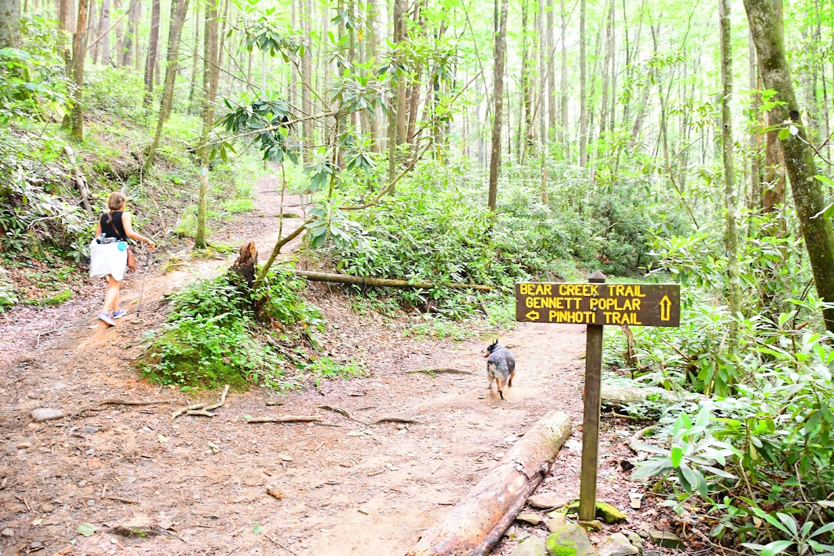
About five miles west of downtown Ellijay, Bear Creek Trail runs through one of the most beautiful creek valleys in the state. The main attraction is the Gennett Poplar — a 100-foot-plus, 18-feet-around tulip poplar spared during the early 1900s logging era and still standing. Popular with hikers and mountain bikers alike.
What to do: Hike the 1.8-mile out-and-back to the Gennett Poplar for the shorter version, or continue to Forest Road 68 for a 5.7-mile round trip through the full valley.
Best time to visit: Spring and early summer for lush forest and a full creek. Fall for color. Avoid after heavy rain if you're not up for wet feet — creek crossings are part of the trail.
Insider tip: Bring an extra pair of shoes or sandals for the creek crossings. And stop at the Gennett Poplar long enough to actually appreciate it — the tree is older than most of the buildings in town.
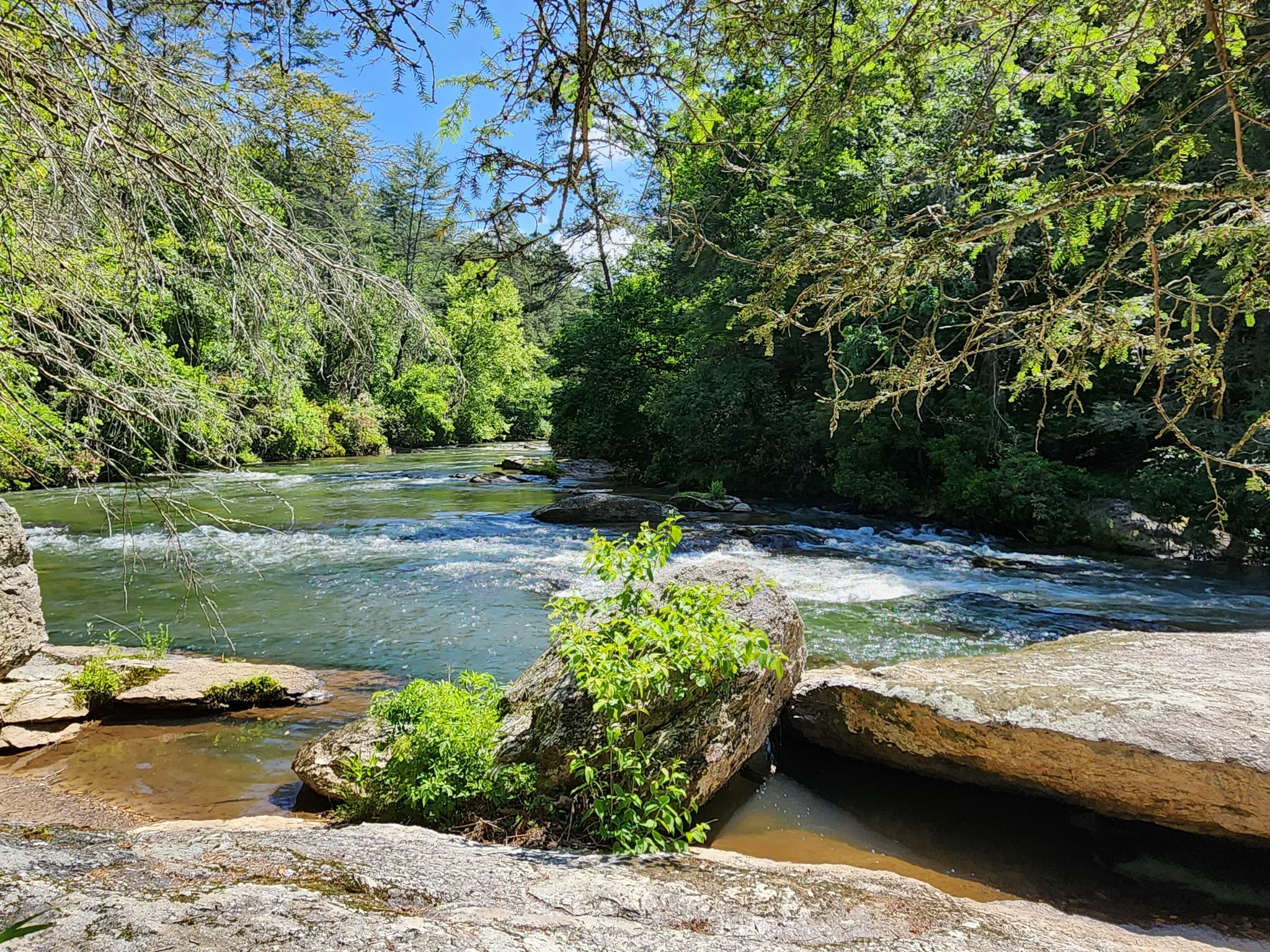
A 3.7-mile loop in the Rich Mountain WMA, moderately challenging, with about 479 feet of elevation gain. The trail stays close to the Cartecay River for most of the loop, offering easy access to swimming holes and river views, with stretches of rocky and sometimes slippery terrain.
What to do: Hike the full loop at a relaxed pace. Plan a swim break on a hot day — there are multiple good spots to drop in.
Best time to visit: Late spring through early fall for the full river-swimming experience. Winter hikes are beautiful but much colder.
Insider tip: Same rules as Blackberry Mountain Clear Creek — you need a Georgia DNR land pass or valid hunting/fishing license. Also, trail markings can be inconsistent; download an offline map before you start.
Planning Your Hikes
If you've got one morning and don't want to overthink it, do Tumbling Waters or Fort Mountain Lake Trail — both are short, scenic, and deliver immediate payoff. If you've got a full day and want something that feels like an adventure, Bear Creek to the Gennett Poplar is the pick. If you're chasing waterfalls, string together Barnes Creek Falls and Blackberry Mountain Clear Creek in the same afternoon.
A few practical notes. Two of these trails — Blackberry Mountain Clear Creek and Cartecay River Loop — sit inside the Rich Mountain WMA and require a Georgia DNR land pass. It's a small annual fee and easy to buy online, but skipping it is a real problem, not a technicality. Tumbling Waters has a $3 day-use fee. Everything else on this list is free.
Weather matters more than it does in the Piedmont. Waterfall trails come alive after rain and go quiet during dry spells. Creek crossings get harder (and sometimes impassable) after big storms. Mountain weather shifts quickly in spring and fall — bring a layer even when the forecast looks warm.
And the usual gentle reminders: pack out what you pack in, keep dogs on leash where required, and say hi to the people you pass on the trail. Ellijay hiking is quieter than most of North Georgia's better-known destinations, and the people who love these trails would like to keep it that way.